The HAYS HUMM - November 2018
TOM JONES & BETSY CROSS
Jeri Porter
Jeri Porter
About Myself - I'm the oddball here since I am a member of the Capital Area Master Naturalist, but do a lot of my volunteer work in Hays County as the guide coordinator for Jacob’s Well. I grew up at Fischer, lived in Austin for 50 years and moved back to the country in 2011 when I became involved in the Jacob’s Well program. My daughter and her family live in my long time home in West Lake Hills, where I split my time with the Fischer house. I completed my MN training in 2002, served as the training coordinator for two years, was President of the CAMN program for one term and currently serve as an advisor to that chapter. The Master Naturalist program has opened up so many new adventures for me that I will always be grateful for the opportunities it has provided.
What You May Not Know - My great grandfather came to Texas in 1849, shortly thereafter purchased land at Fischer and created a general store. The third store is still in operation, as is the ranch where I live in a house built in 1910. Our community was recently designated a Historical District in the National Register of Historic Places which has led to my becoming involved in the Comal County Historical Commission.
My favorite MN Activity - Being part of the guiding group at Jacob’s Well. We have a group of eight guides who lead tours each Saturday from September through May. We assist the staff educating the public on various aspects of water issues at Jacob’s Well, as well as teaching about the history of the site, geology, native plants, water conservation and the importance of this water source for the City of Wimberley.
Bird I Most Identify With - Eastern Bluebird. I have been a member of the Texas Bluebird Society for a long time and am a box distributor. They are such beautiful birds and it always brightens my day to hear their call as I work in my garden.
Susan Neill
Susan in her pollinator garden
About Myself - I received a BA degree in Microbiology from the University of Texas (Hook ‘em!) and a Ph.D. in Microbiology from the University of Illinois. That led me to spend 24 years with the Texas Department of State Health Services laboratory, with the last 10 years as the Laboratory Director. After moving to Dripping Springs in 2005, I became interested in the Master Naturalist program to become a better steward of our property (and to look at things larger than bacteria and viruses) and was finally able to join the program in 2014, graduating as a member of the Monarch class. The program opened my eyes to new and better ways to manage our property and look at the environment overall.
You may not know – While growing up in Houston, I always said I wanted eventually to live on a square mile. I may not live on a square mile, but I consider our few acres in Dripping Springs a little slice of heaven.
Favorite MN Activity - I volunteer as a docent and lead tours at Westcave Preserve. I have met visitors from all over the world covering all continents except Antarctica. Two of my favorite points on the tour are the “oohs and ahs” when visitors first see the grotto and expressions of peace and happiness on visitors faces when we take 30 seconds “to just listen” as we end the tour.
First Fall Monarch - Zilker Park - September 26, 2018
A couple of weeks ago a friend of mine sent a text, “Anybody know the monarch butterfly forecast?”
I did a quick Internet search to see if I could answer her question. And my take on it is that while the monarch watchers appear to be very optimistic this year, until these butterflies reach their destination in Mexico, it is still a rather vague and hope-filled prediction.
Male Monarch on Frostweed - October 25, 2018 – 2:15 PM
I saw my first fall monarch of 2018 at Zilker Park in Austin.
Then yesterday (October 26) the monarchs started arriving in my yard in significant numbers. I’ve observed more monarchs in just a few hours than I’ve seen in total since moving to Hays County three years ago.
At least twenty unique individuals can be seen at a time in one small area of my yard…truth is, in the wild flurry of activity, there are more than I can count!
This influx is timed perfectly with the revival of fall pollinator plants - a very good sign for the 2018 fall monarch migration!
The monarchs seem to be most active in mid-morning to mid-afternoon.
They are pumping up on nectar from a White Mistflower shrub in my yard and are also very busy working a stand of Frostweed at the back of my property.
It appears to me that males outnumber females by about four to one. Though my observation is purely unscientific, I wonder if it has any significance.¹
October 27 - 10:30 AM - Monarchs sampling my neighbor’s salvia
Impact of Summer Breeding Grounds This summer and into early fall, my business partner and fellow nature-lover from northern Indiana observed a noticeable increase in his local monarch population. In sharing this with me, he recalled a time in the early 80’s when monarch caterpillars were readily collected by his young son, and yet in the more recent past, his now grown son had taken his grandson out into the field to see the caterpillars, only to discover that none could be found.
But there has been a movement afoot in his community to restore monarch habitat by planting medians, parkways, and vacant lots with native milkweed.
And it seems to be making a big difference!
“Two Sides of the Same Coin” The monarch below on the left is most likely a 5th Generation monarch. Unlike her predecessors she will live up to eight months. She is preparing to journey 2,000+ miles to her overwintering home in Mexico, where she will stay until early spring and produce the first generation of monarchs for the return migration north. Perhaps she started out in Canada or Michigan and has just stopped over in South Bend, IN on September 16th to stock up on nutrients before continuing. Or maybe she was born in South Bend and is just getting ready for her long journey to the south.
The photo on the right was taken in my yard on October 26. It is also a 5th Generation monarch that has already traveled over 1,000 miles and is more than half-way to its final destination.
Could the butterflies in these two photos be the same individual?
How long does it take a monarch to travel 1,200 miles from South Bend, IN to San Marcos, TX? 20 days? 30 days? 40 days?
The USDA Forest Service states that monarchs can travel 50-100 miles in a day; and it can take up to two months to complete their journey.
Can monarchs fly through rain and wind storms, or do they have to stop and wait it out?
(Scientific American) During heavy rains and wind, butterflies are rarely seen. Not only does rain pose a direct threat of injury or death, but the cool air associated with storms may also reduce temperatures below the thermal threshold for butterfly flight.
If the South Bend monarch pictured above leaves on September 26 and travels 50-100 miles per day, and if the weather is clear and calm for the trip, it could arrive in San Marcos within 12-24 days. However, if the weather is rainy and windy, our monarch will have to take cover and wait it out. With the heavy rain and wind in September/October, it could easily take the monarch 30 days or more to arrive in San Marcos. So, yes, the monarchs in the photos above could be “two sides of the same coin” - it is possible they could be the same butterfly!
The summer monarchs of northern Indiana are making a comeback. Where milkweed has been planted and is being allowed to flourish, monarch numbers have increased. Where monarch sightings had once become rare, they are becoming commonplace again. The importance of repopulating native milkweed in the Northern US and across the Midwest cannot be overemphasized. It is obviously helping these beautiful, amazing insects.
Can we point to it as a factor in the 2018 migration that we are seeing here in Hays County? This enthusiastic Master Naturalist says, “YES!” I am optimistic we are on the right path. It seems that concerned citizens are joining with nature lovers across the nation in strategic efforts to improve habitat for monarchs. This is good news!
Can more be done? Definitely! The promotion of native landscapes and the deliberate addition of fall pollinator plants is another step in assisting the migrating butterflies, as well as for all wildlife and the ecosystem in general. Organizations such as Monarch Watch, Native Plant Societies, and our own Texas Master Naturalists are impacting the efforts to save these beautiful butterflies through outreach, education, and milkweed restoration.
Article and photos by Betsy Cross with special thanks to Tim Liddell for use of his photos.
¹After writing this article, I was searching for additional information on the migration and ran across a reference about the male to female ratio. Interestingly, it confirmed my observation, stating that during the breeding season, the ratio of males to females is the same, but during the migration, the ratio is skewed toward males, adding that fewer than 30 percent of the migrating monarchs are females. This would be very close to my observed 4:1 ratio of males to females. I was relieved to read this, as I was slightly worried that there might not be enough females, but apparently, this is a known fact and quite normal.
Click on photos and graphics to enlarge and view in lightbox
The Wimberley area is the destination for many visitors and residents attracted by the numerous hills, deep valleys and multiple water features throughout the area. The region surrounding Wimberley is locally referred to as the “Wimberley Valley”. This western corner of Hays County covers a large slice of the Texas Hill Country that includes the Blanco River and Cypress Creek watersheds. These long valleys are separated on each side by elevated ridges that have been carved into an incredible assortment of hills of every shape and size. In this article, the focus is on the role of water in forming the Karst landscape of the Wimberley Valley.
Honeycomb limestone
Karst is a topography or terrain formed by rainfall entering into and dissolving the abundant limestone formations. Common characteristics of karst terrain include underground features such as sinkholes and caves. It also has created vast underground drainage systems within aquifers that allow ground water to easily enter and move through the rock layers. Good examples of this type of karst feature can be seen from the abundant examples of honeycomb limestone used to landscape yards and many entrance gates. It can have a big impact on rivers and creeks by reducing stream flow in some areas while increasing the flow via springs in other stretches. The Blanco River and Cypress Creek have many good examples of how karst impacts water flow. Karst also plays a key role in forming the Texas Hill Country look.
HOW KARST WORKS - Sinkholes, caves and honeycomb limestone are karst features formed by rainfall slowly dissolving the limestone layers. As rain falls through the atmosphere it picks up carbon dioxide (CO2) and becomes acidic. Typically rainfall has a pH of 5.5 which is slightly acidic, similar to the pH of sparkling waters. For comparison, tap water has a neutral pH of 7 and Pepsi’s pH is 2. Over thousands or millions of years, rainwater has continued to fall on and enter into the land surface via the numerous faults and fissures. The acidic water slowly dissolved the limestone causing the cracks to enlarge and the faults to widen.
Blanco River at low water crossing downstream of Fischer Store Rd. bridge. This is an example of the river changing course to follow a fault . Note weathered cliffs along fault trace, a common feature in the Hill Country. Photo location shown on Fig. 1.
Figure 1 - Map of faults and karst in the Wimberley Valley -reference: Hydrogeologic Atlas of the Hill Country Trinity Aquifer, Wierman, Broun & Hunt, July 2010
Figure 1 is a map of the Wimberley Valley. The deep valleys formed by the erosive action of the Blanco River and Cypress Creek are roughly parallel and extend from Wimberley to the northwest. The alignment of both of these watersheds parallels the alignment of fractures in this area. The watershed ridges or divides are the high hills and meadows that trend in the same direction. Ranch Road 2325 follows the ridge from Wimberley northwest toward Blanco, offering overviews of these expansive valleys. The other important feature shown on the map is the high concentration of faults that stretch across the valley bisecting both rivers and hills. The overall effect of these faults and the network of fractures or cracks they created is to effectively break the landscape into many large blocks. Rainfall enters these cracks, dissolves the limestone helping to smooth and shape the terrain into the hills that we see today. Figure 1 also shows the approximate locations of where karst features are observed at the surface. It is not surprising that the karst features occur near the rivers and the fractures.
EXAMPLES OF KARST IN WIMBERLEY VALLEY
Pleasant Valley Spring - Kendall Yates, Research Assistant with the Edwards Aquifer Authority measuring the flows at PVS. In the background you can see the fracture associated with the spring on the rock outcrop.
Pleasant Valley Springs (PVS) - PVS is the largest documented spring of the Hill Country Trinity Aquifer system and is located 5 miles from the well-known Jacob’s Well Spring (JWS). If you drew a line connecting PVS and Jacobs Well Springs, the direction of this line is consistent with the many faults in this area. PVS is a perennial (flows continuously), artesian spring located in the bed of the Blanco River. The resulting water flow issues from multiple fractures along the riverbed. The total spring flow is over 4,000 gallons per minute and is a significant contribution to the Blanco River base flow. It should be noted that the surface elevations of PVS and JWS are very similar. The elevation of PVS is 921-923 ft-mean sea level (msl) as compared to Jacobs Well’s elevation at 922 ft-msl. Both springs have a common source, which is the subsurface Cow Creek formation, the source of artesian flow to both of these springs.
Figure 2 - PVS Cross-section illustrating water flow into Saunders Swallet (sinkhole) and returning to the surface at PVS.
Another prominent feature above PVS is known as Saunders Swallet or sinkhole. The sinkhole is located in the stream bed of the Blanco River causing water to be diverted to the subsurface aquifers, thus reducing the river flow. Some of this flow is returned to the surface via the fractures at PVS. This is a good example of how karst topography can impact the Blanco River flow. Figure 2 is a general cross-section illustrating the flow from Saunders Swallet to PVS.
Jacobs Well Spring - While springs issue from fractures at PVS, JWS has a karst conduit system (cave) extending 140 deep and over 5,000 ft horizontally. The cave formed along fractures with roughly the same orientation as those observed at PVS. Figure 3 and the JWS photos illustrate the subsurface karst topography of JWS. Some have suggested that PVS and JWS are connected from their common aquifer source, the Cow Creek Limestone. No definitive test has been conducted to verify a connection, but the data suggest this is a possibility.
JWS is slowly changing from a perennial to an intermittent spring due to droughts and increased groundwater pumping. PVS was observed to flow during recent droughts when JWS ceased flowing. Decreasing base flows in the Blanco River over the past few decades suggest that the PVS is also decreasing over time, and is impacted due to the combined effects of drought and groundwater pumping.
Figure 3 - Cross-section of Jacobs Well Spring: Subsurface cave created by water dissolving limestone along fracture system.
Jacobs Well Spring: Note the fracture extending from the cave opening. If you could trace a line downstream along the fracture, it would point to the Blue Hole.
Jacobs Well Spring: Photograph showing the karst enlarged fracture routing groundwater to the surface. If you click on the photo to enlarge, you will be able to see the diver in the center of the photo shining a light. A good reference for the size of the cavern.
The karst region in the Wimberley Valley does influence land use and water resources. Potential impacts include sinkhole collapse, increased groundwater contamination risk, and an unpredictable water supply. The honeycomb limestone is effective in quickly moving ground water through the aquifers which can result in reduced water availability for this region. Decreasing stream flows may also impact the ecology of the Hill Country. Karst gives this region its iconic Hill Country look and enables the numerous creeks and springs that attract people to live and visit the Wimberley Valley.
Views from the TMN State Meeting
Photos Contributed by Mary O’Hara
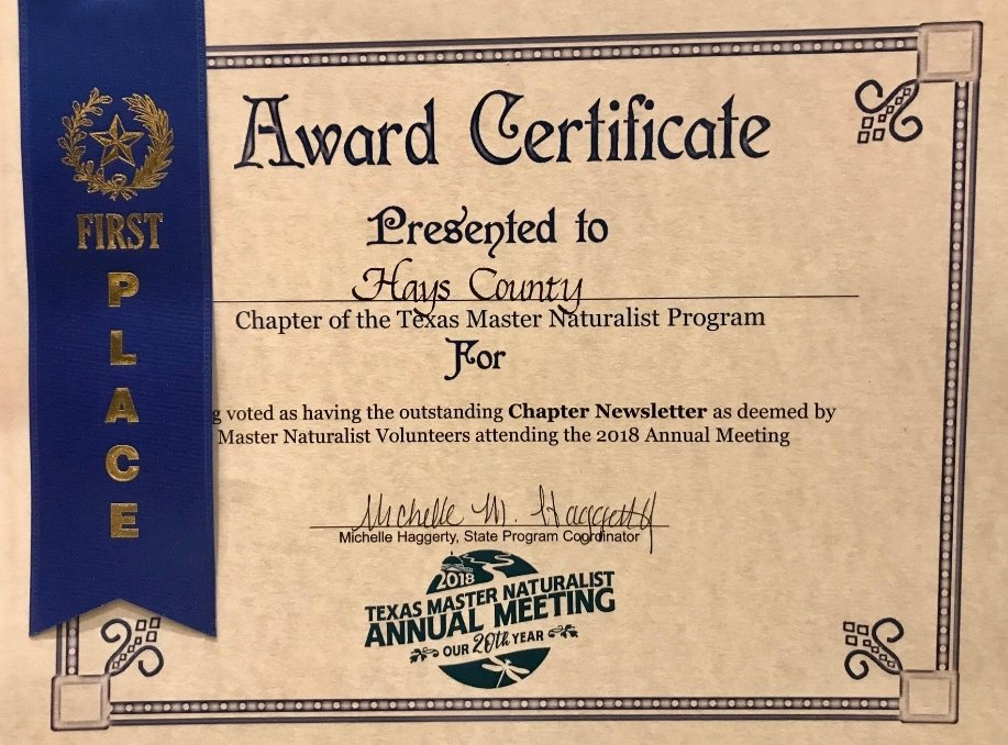
October 25th-28th, some of our HCMN members participated in the 20th Anniversary Annual State Meeting. This jam-packed weekend offered 152 different presentations and field sessions with a variety of topics and speakers from around the state: from Dark Skies to the Underground World of caves and everything in between. Multiple volunteer milestones were celebrated and, our beloved Hays Humm, received 1st place in the newsletter competition.
Click on image to enlarge and view in lightbox
THANK YOU - KAREN FORD
Thank you all for your hours of service and support for the 2018 Hill Country Living + Rainwater Revival FESTIVAL. Truly, this event could not happen without you. We are so grateful for your time, your know how, your get ‘er done attitude, and for being a happy face for the event.
The Festival was a solid success in our minds! Certainly there are areas for improvement, and we truly appreciate the input we’ve received from Volunteers so far. We’re listening and taking notes and are committed to do it even better next year — hopefully with your help again! If you have additional thoughts for us on how the event can be made better as we grow bigger (more attendees!) — please let us know. On behalf of the Hill Country Alliance, thank you Volunteers for being one of the very best parts of the 2018 FESTIVAL!
Photos by Dan Zin and Tom Jones




















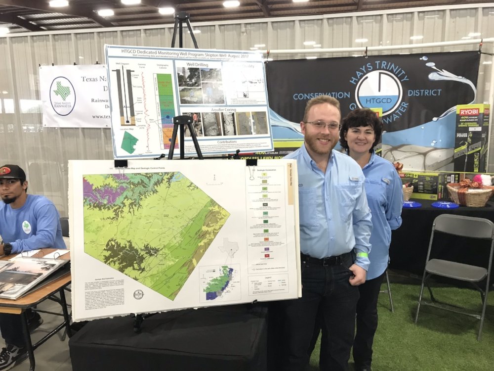


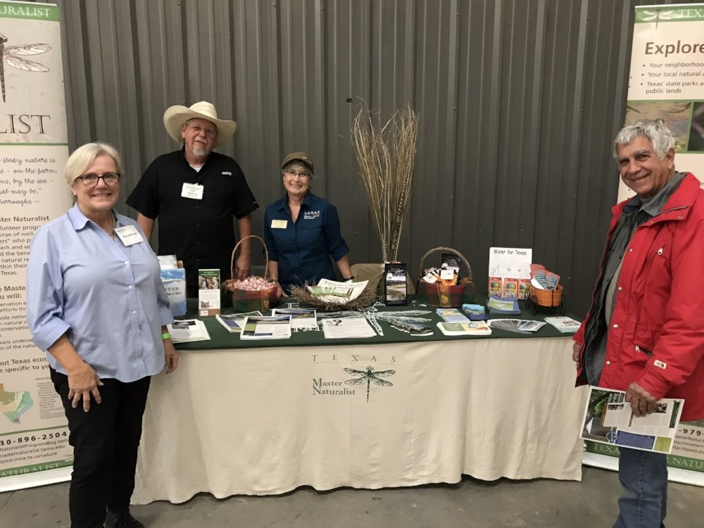

Photo by Beverly Gordon
It was taken Oct 14 during the AT Grass Walk at Westcave Preserve with Bill Carr
