Mustang and North Padre Islands
Port Aransas to Mansfield Channel
Art Crowe
Geology and History
Padre Island is recent in geologic history, under 5000 years old. The island is shaped by the day-to-day actions of the prevailing southeasterly winds, currents, waves, and tides, especially storm tides. April is the windiest month. Those steady 20-mph southeasterly flows can wear you down if you are out in it all day. It wears down dunes too, keeping the fore dunes down to a height of under fifty feet. Behind the fore dunes are vegetated flats with scattered, somewhat stabilized dunes; these give way to wind-tidal mud flats and finally the famous shallow water grass flats of the Laguna Madre. Hurricanes are an occasional process that temporarily changes the islands.
For instance, as you drive from North Padre onto Mustang Island, there is no way to know when you cross from one island to the other. There is no water between the two islands anymore. There are, however, four different passes that have closed completely. One of those is Corpus Christi pass, where Alonso Alvarez de Pineada first sailed into Corpus Christi Bay in 1519. History buffs should check out the Corpus Christi Museum of Science and History. Mustang Island gets its name from wild mustangs that were released by the early Spaniards. There are two manmade passes of importance. Packery Channel connects Corpus Christi Bay to the Gulf for fishing vessels. Mansfield Pass connects Port Mansfield to the Gulf for commercial and sports vessels. Mansfield Pass effectively cuts the island in half, into North Padre and South Padre.
Things To Do
Beaches: There are 80 miles of beaches, including nine public beaches, where you can fish, swim, surf, wind-surf, and build sandcastle. What I enjoy most is just watching the people and their dogs. Padre Island National Seashore is the longest undeveloped barrier island in the world. Camping is allowed on the beach at Mustang Island State Park and on the National Seashore. Four-wheel drive is recommended! Even with 4-wheel drive, if you are not familiar with driving on sand, it is recommended that you bring plenty of beer with you. Even if you don’t drink, you can always try and bribe people with beer to help you get unstuck.
Kayaking: Located in Aransas Pass, Coastal Bend Kayaking offers instructions as well as trips on the island and the Aransas National Wildlife Refuge. Try it on your own at the first designated kayak trail in the state: Lighthouse Lakes Paddling Trails. There is a series of four loops ranging in length from 1.25 to 6.8 miles, all located near the historic 1857 Lydia Ann Lighthouse. Mustang Island Paddling Trails offers three different trails located along the west shore of Mustang Island, ranging in length from 5.25 to 8.5 miles.
Nearby Bird Watching: Most birders are familiar with the Rockport area as a major stopping point for spring migrants, but did you know that Corpus Christi has been voted the “birdiest” city in the USA? The King Ranch also offers a variety of tours during the spring.
Island Bird Watching: You don’t have to pay anything to test your birding skills on the many shorebirds that frequent the beach and backwater tidal flats. The best place to view a variety of shorebirds and spring migrants can be found at the Leonabelle Turnbull Birding Center. It has boardwalks over both a freshwater and a saltwater marsh. It is located just blocks from where the Port Aransas free ferry docks. Show up on Wednesday mornings at 9:00 for a guided tour.
Fishing: Try your hand at kayaking or wade fishing the back bays, jetty fishing at Packery Channel or Mansfield Channel, surf fishing 80 miles of open beach, and great snapper fishing offshore. The 1,240-foot-long Horace Caldwell fishing pier in Port Aransas is open 24-hour a day. While the Bob Hall Fishing Pier has been closed since Hurricane Harvey, plans are underway to replace it soon with a bigger pier.
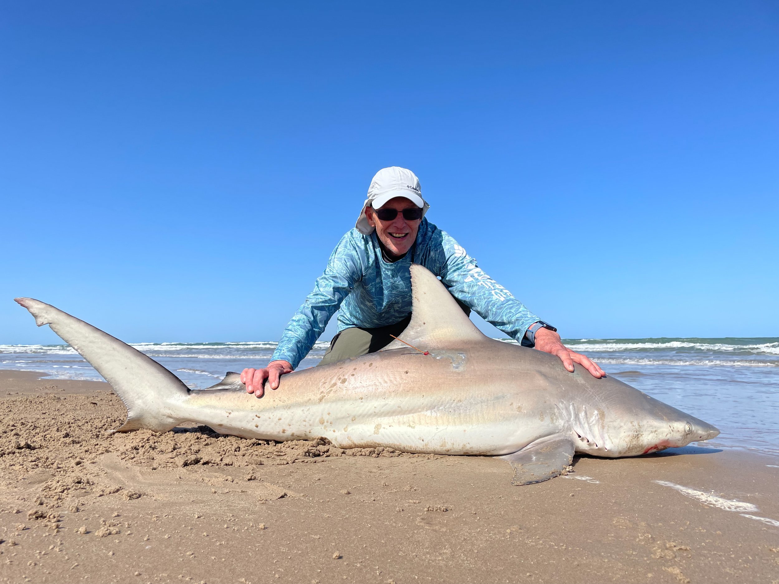
I wanted to try some extreme fishing on my recent stay on North Padre. I hired the legendary shark fishing guide, Eric Ozolins to try my hand at tagging and releasing big sharks https://oceanepics.com. Eric has tagged over 1000 sharks during the past twenty years. I was hoping for a big, scalloped hammerhead or tiger shark in the 10–12-foot range. Spring into summer is when the big sharks come in close to shore in search of their favorite food: stingrays. Eric uses a drone or kayak to get the bait, a hunk of cow-nosed stingray, out 400 yards or so to where the big sharks hang out. I was not too disappointed to catch two blacktip sharks at 5.5 feet each, a smaller silky shark, and an Atlantic sharp-nosed shark. In addition, I caught a 36” jack crevalle, a 36” black drum, and a 30” red drum—the five biggest fish I have caught and released in my life!
The Padre Island National Seashore: There is a nice visitor center with informative displays located at Malaquite Beach. There is a designated camping ground and beach that is free of vehicular traffic. Beyond that, there are over 45 miles of open beach, open to overnight camping, fishing, and driving your vehicle. Sixty years ago, when Texas gave the land to the Federal Government for the National Seashore, it was with the sole provision that the beach remain open to vehicular traffic. This has created conflicts in the past when it comes to the endangered Kemps Ridley Sea Turtle. Late April into mid-July is when the females come ashore to lay their clutch of between 50-130 eggs. The whole process only takes 30-60 minutes. In part to cut down on turtle/truck collisions, the National Parks Service has been operating a turtle egg rescue program for years, during which they dig up eggs, bring them to a safe spot for incubation, and finally release the hatchlings. These releases are open to the public and are very popular events, especially for the kids. Call the Hatchling Hot Line (361) 949-7163 for up-to-date details of the next release.
There is a hiking trail through the back dunes. You might get a glimpse of coyotes, deer (including exotics that swam over from the King Ranch), badgers, and kangaroo rats.
The only windsurfing operation in a national park, Worldwinds Windsurfing, offers lessons for beginner through advanced windsurfers, as well as paddle board and kayak rentals.
The best shell collection can be found on Big Shell Beach, around mile marker 44.5. Here, the onshore current tumbles shells in from far offshore. By the time they reach the beach, they have been broken and polished, but they keep their vivid colors.
References:
Corpus Christi Visitor Guide: https://www.visitcorpuschristi.com/
Port Aransas Visitor Guide: https://www.portaransas.org/plan/the-island-guide/
B. R. Weise and W.A. White. 1980. Padre Island National Seashore. A Guide to the Geology, Natural Environments, and History of a Texas Barrier Island. Guidebook 17, Bureau of Economic Geology. The University of Texas at Austin.


